
Black Mountain
Background Information:
Altitude: 4,137'
Tidbits: Highest point in Kentucky
Summitted, February 21, 2010
Time Zone: GMT -6 hours
When to go:
Anytime, although winter snows may block vehicle access to the area.
Route Selection:
There is only one route which is accessed via the dirt road described in the "getting there" section.
Hotel and Climb Reservation:
Black Mountain is on private property and you are required to printout and carry a signed waiver with you while on the property. The waiver may be downloaded HERE:
Packing List:
None.
Getting There:
It is a bit tricky...From the Kentucky-Virginia state line go east on Route 160. You will come to a "Y" intersection with a paved road that has a gate and small road with a sign for "FAA Radar facility"...take the small road for 1.75 miles. At this point the road becomes a dirt road. After another 1/10 of a mile there is another dirt road on your left, take this another 1/10 of a mile to the summit (NOTE: when I was there this last section was not passable, so I simply walked the last stretch.
Trip Description:
This section of the country is unlike anything I had experienced elsewhere in the US. Incredible beauty and incredible poverty. The hike itself is short and the views are limited. There is no cell service (at least when I was there) and it's not a place you want to get stuck or broken down. There was quite a bit of snow which I didn't expect this far south, but it did add to the beauty.

Highpoint approach road

Final section of (unpassable) approach road...easily hiked

Summit view
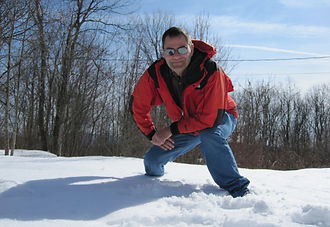
Summit selfie